🌍 Fun Websites for Geography Enthusiasts
2025-03-15

Real-time Global Weather Map
Explore current weather conditions through interactive maps of rainfall, wind, temperature, and pressure. Check your local forecast, track hurricanes and storms, monitor wildfires and smoke, and stay updated with near real-time satellite images and rainfall radar.

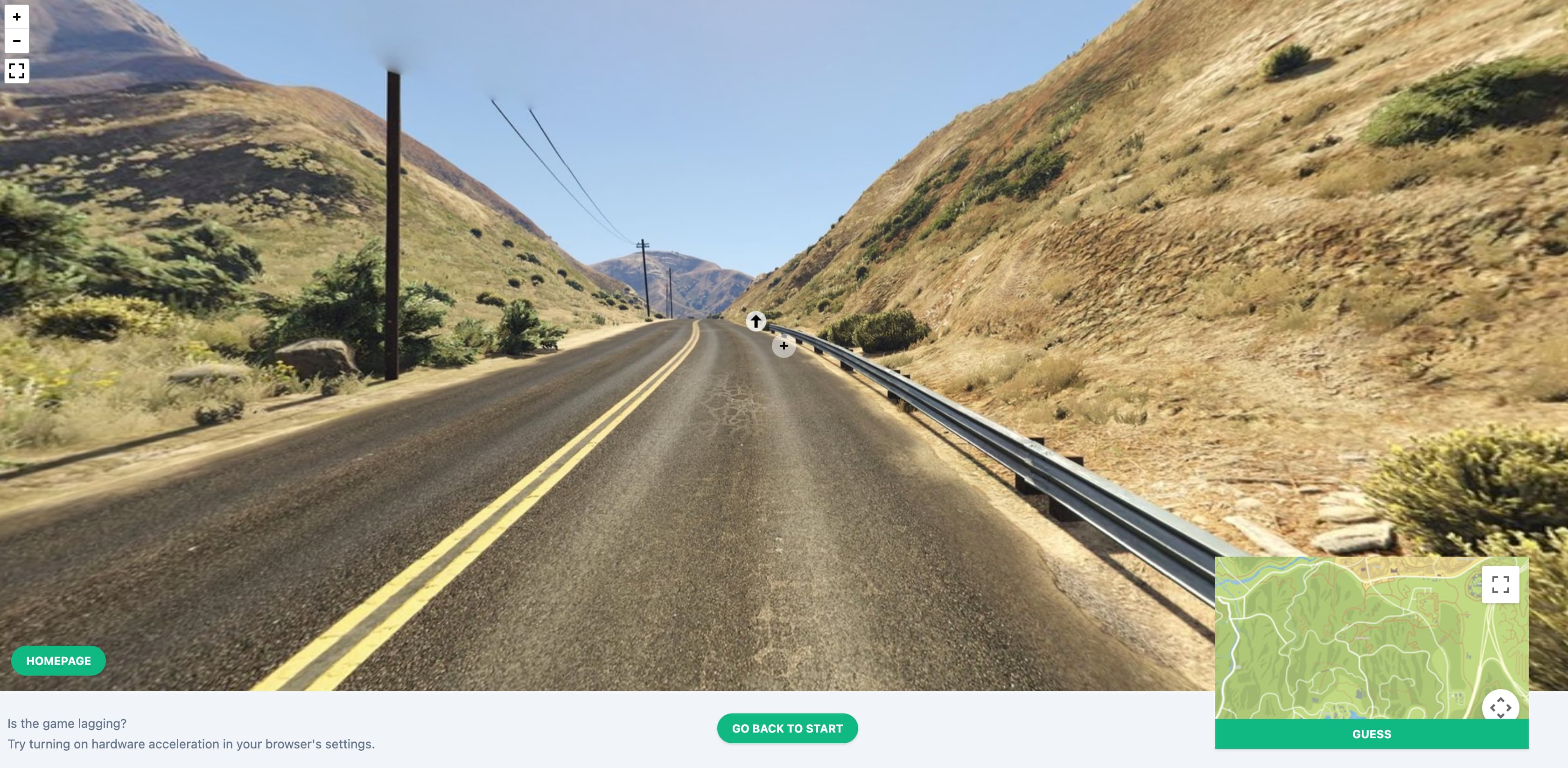
GTA GeoGuessr
The game provides only street view images and a compass—no other hints. Players must determine the location using clues like road signs, vegetation, businesses, climate, and landmarks. You can also move, pan, and zoom the street view for more information.
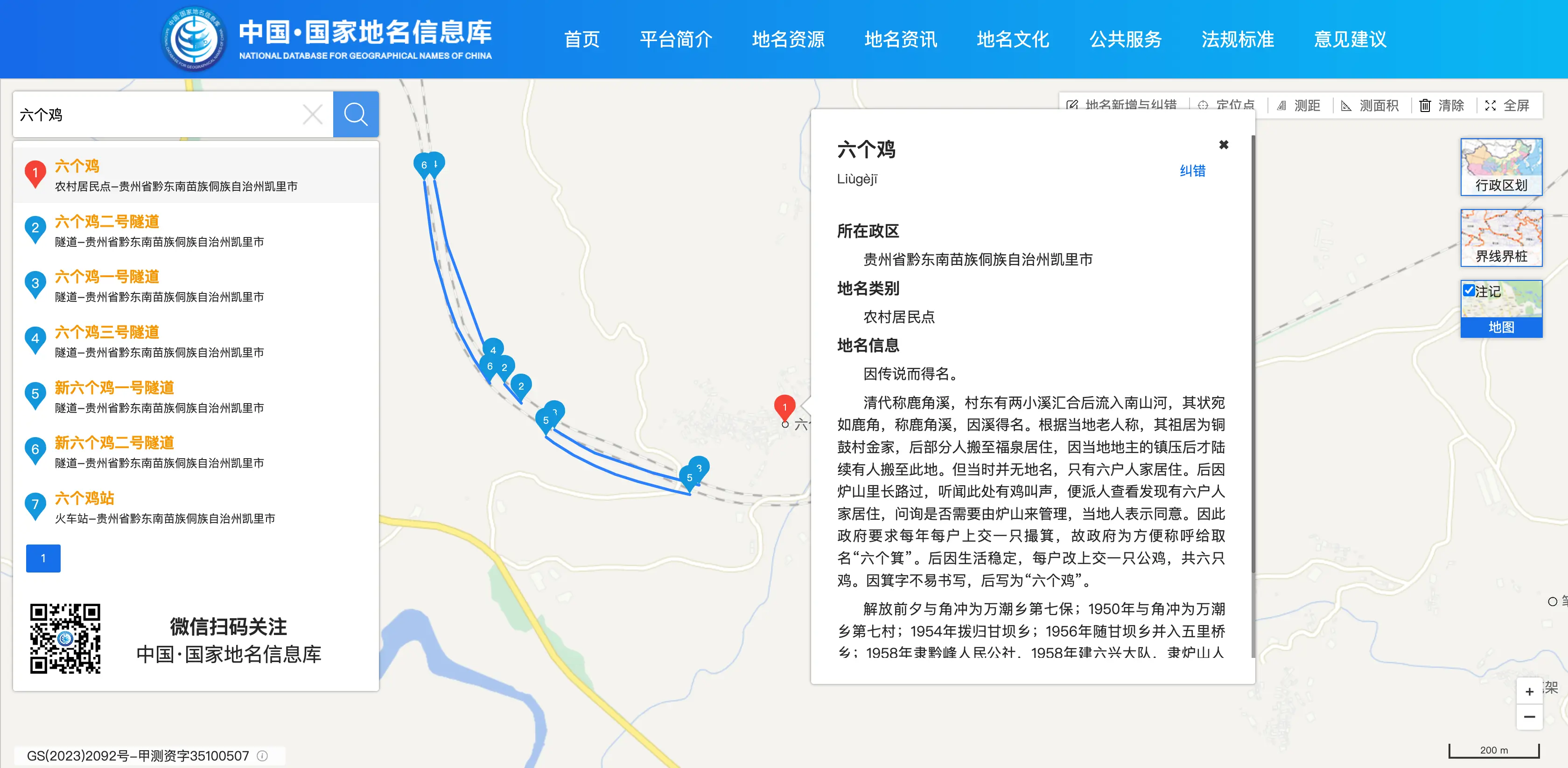
National Place Names Database
This government-maintained database contains all standard place names in China, as well as foreign, underwater, polar, and even lunar place names. It’s like a global directory of place names, allowing you to search for names, download administrative division data, and learn the cultural stories behind them. For example, you can look up the standard name for the “Yellow River” or learn the origin of a place name.
OCEARCH
Track the global movements of great white sharks, orcas, and other marine animals via satellite. The site provides scientific data such as weight and age, and each animal has a dedicated page with documentaries and conservation stories.
![]()
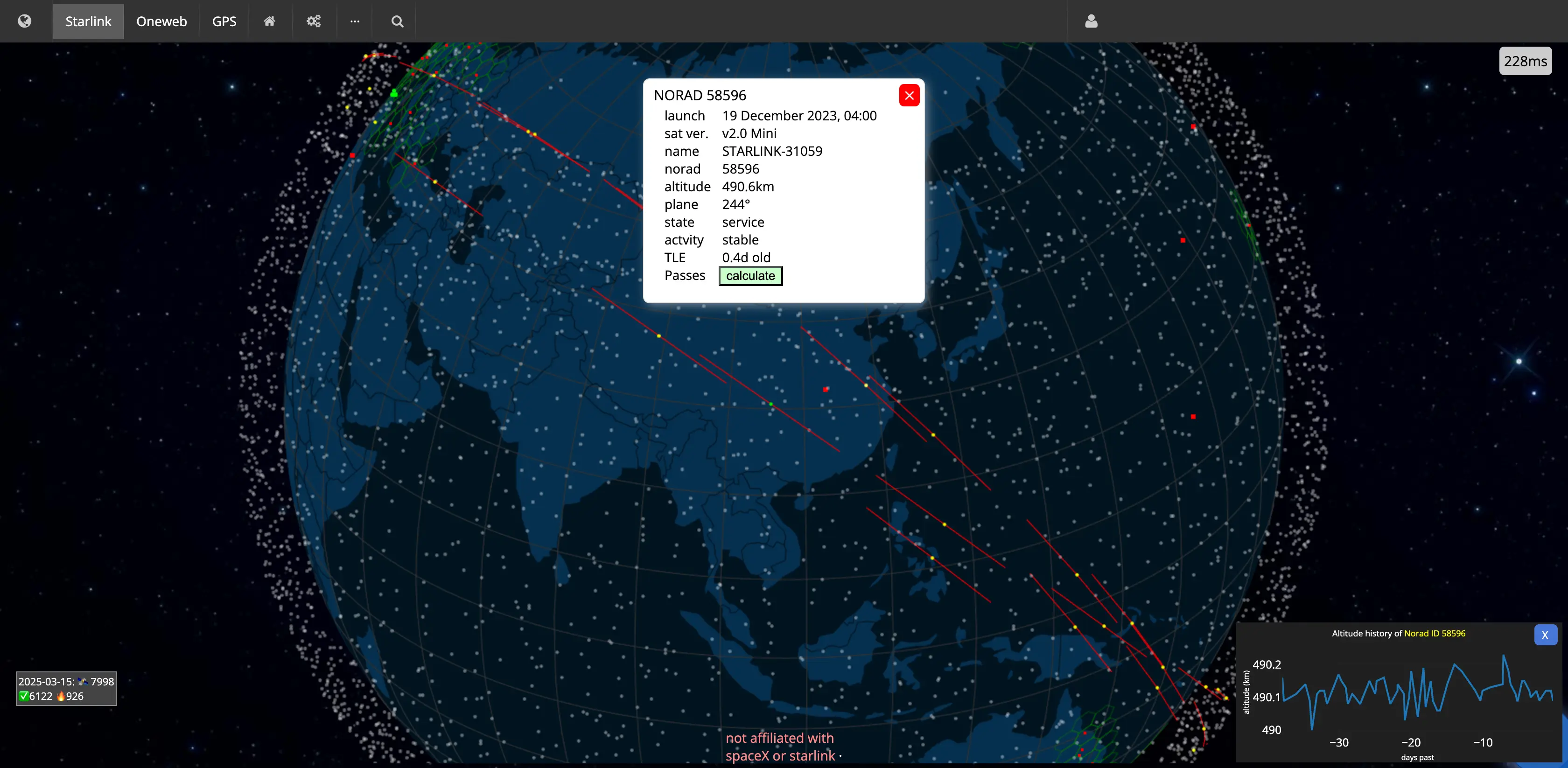
Satellite Map
Displays the real-time positions and coverage of Starlink, Oneweb, and GPS satellites, helping users understand the distribution and density of artificial satellites above Earth. The intuitive map interface allows users to view satellite positions and orbits in real time—useful for both astronomy enthusiasts and general users.
UFO Stalker
A GIS-based UFO event database supporting spatiotemporal data visualization and analysis. It provides event details, photos, videos, and more, and integrates a system for submitting and verifying reports.

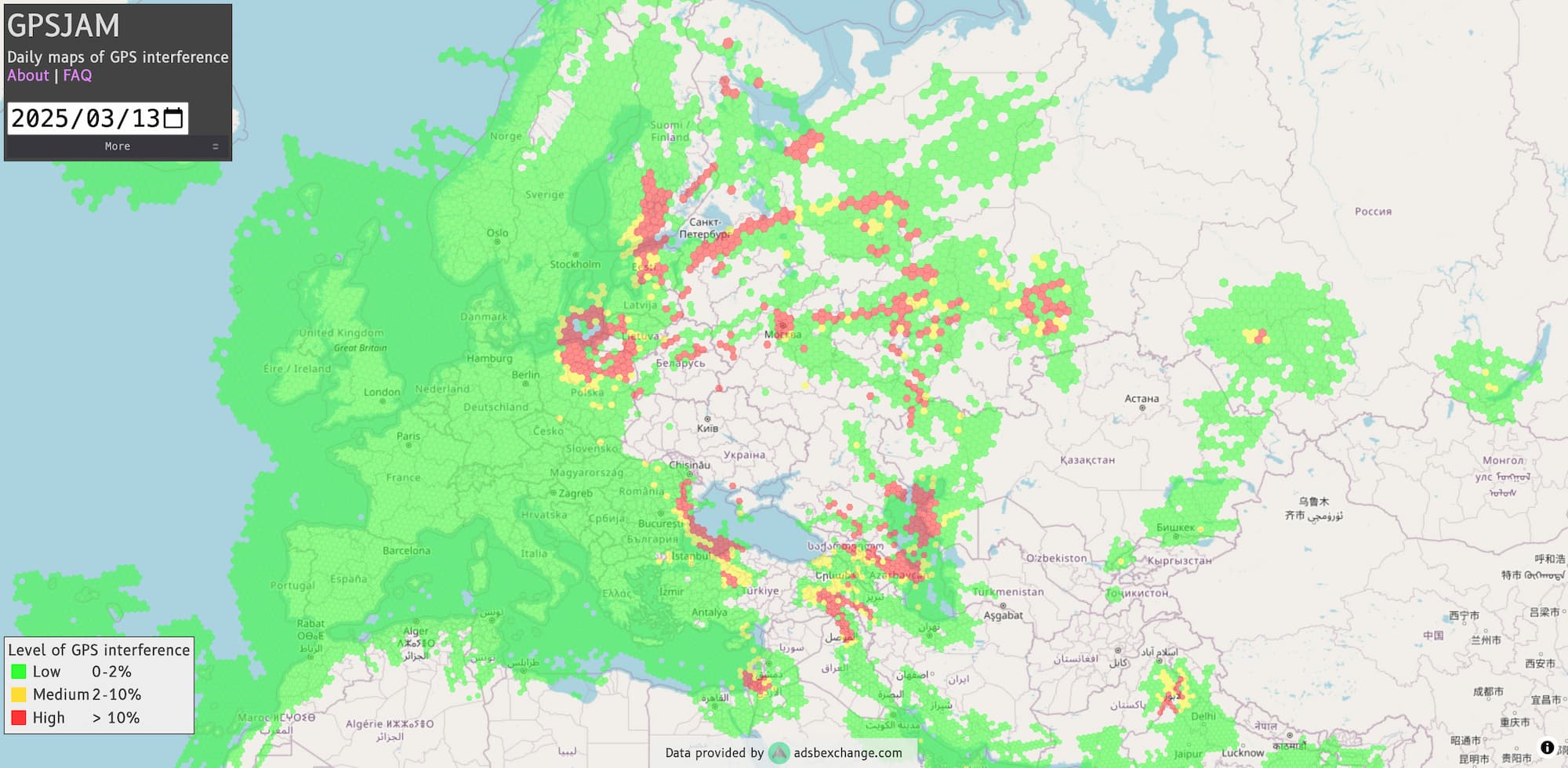
GPSJAM
This map lets you view global aircraft navigation accuracy: green indicates good accuracy, red indicates poor accuracy, so you can instantly see GPS interference around the world.
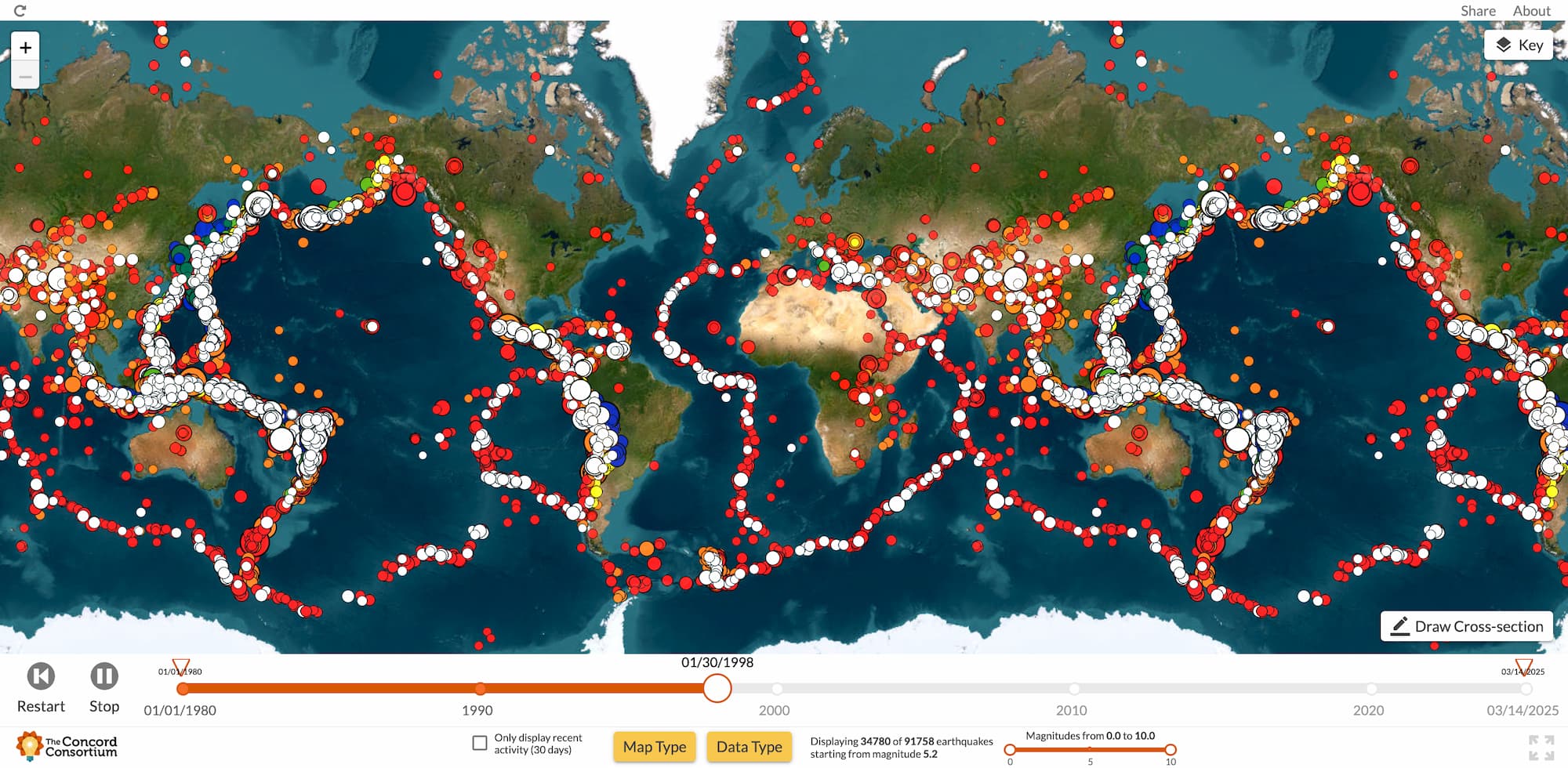
Global Earthquake Information
Seismic Explorer displays global earthquake data since 1980. Users can view seismic activity, epicenter locations, and plate boundaries to determine if their area is prone to earthquakes.
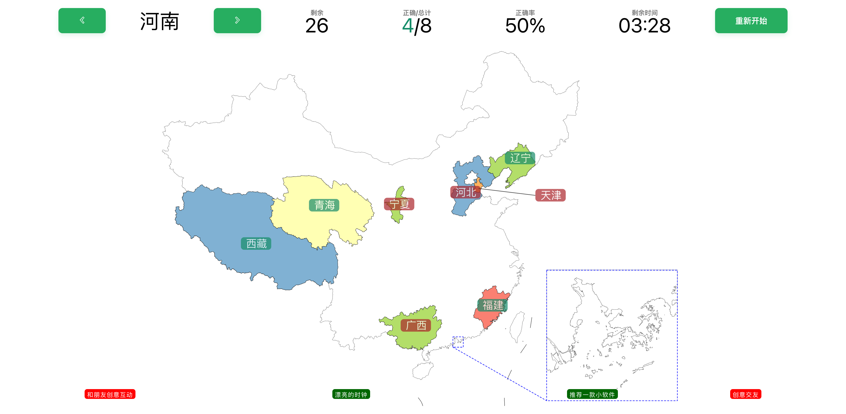
China Provinces Quiz
How well do you know the geography of China’s provinces? Try this interactive quiz: click the correct province on the map according to the prompt and see how many you can get right!